 Slavery
to
freedom

Harrisburg on the eve
of Civil War
Study Areas
The Violent Decade
Paxton Creek and the Industrial Canal
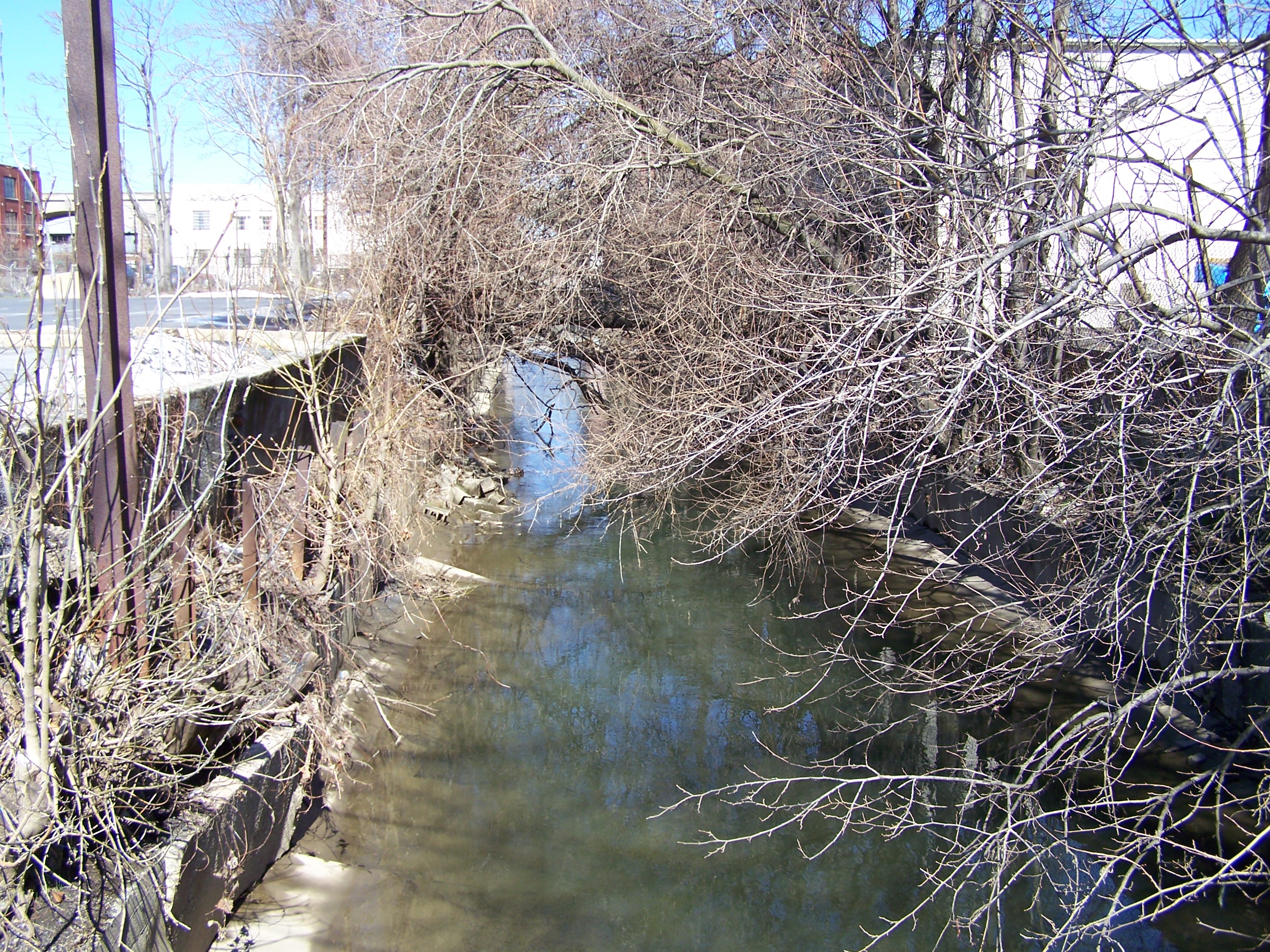
Just as the Susquehanna River defines the western boundaries of Harrisburg, two other waterways, one natural and one man-made, defined the town's eastern perimeter. Both played a significant role in the development of the town's African American community, and its subsequent anti-slavery activities.
Paxton Creek is an important waterway that lent its name to the area when it was still a wilderness township of Lancaster County. John Harris settled near where the creek emptied into the Susquehanna River, a spot which was already a popular campsite for local Native Americans. As the town developed, the swampy lowlands surrounding the creek defied both farming and development, although the waterway did lend itself to use by tanneries, gristmills and sawmills.
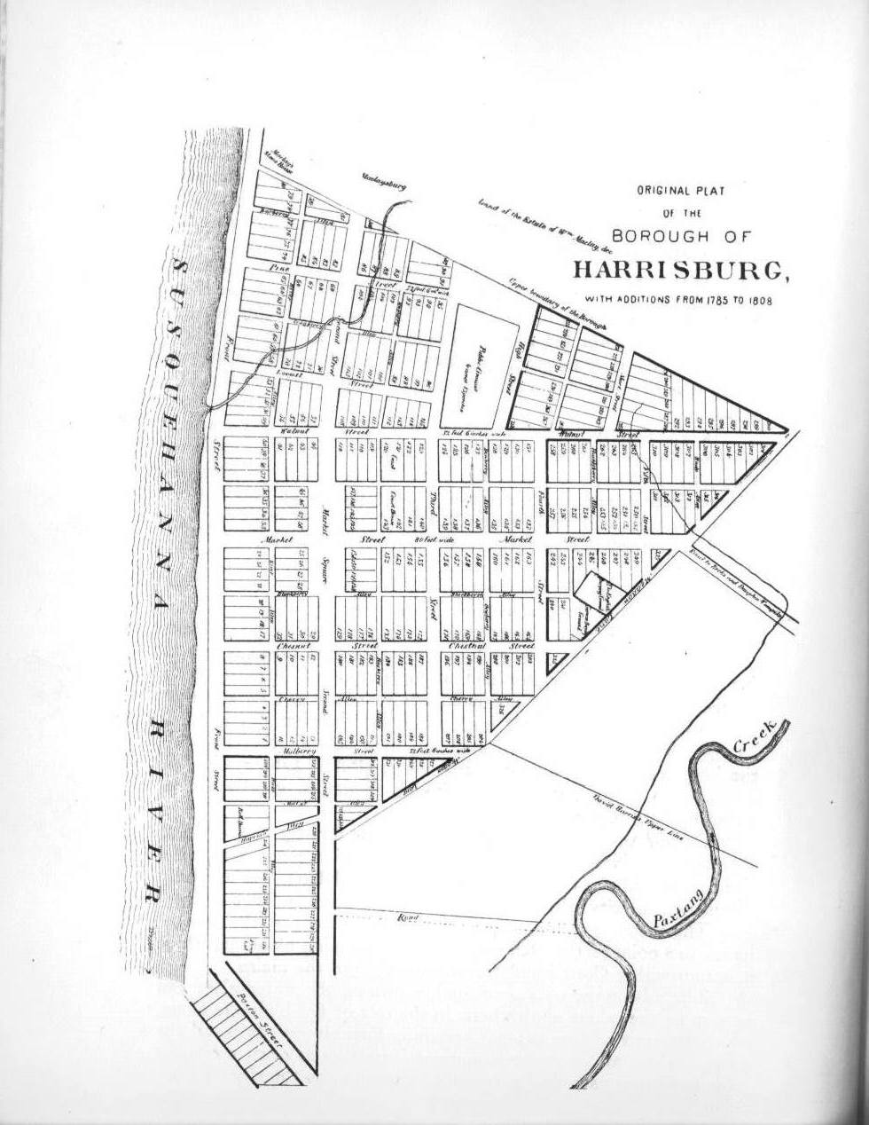
An old plat of the town shows the distinct lines of the town's eastern boundaries. with all of the intervening land sloping downward toward the creek. Because these sloped, often swampy areas were less desirable for building, they became the areas first inhabited by incoming African Americans in need of low-cost housing. The first significant area in which free African Americans clustered in Harrisburg was the block bordered by Third and Fourth streets and between Market and Walnut streets, situated on the northern limits of the town in 1810. Running east and west through the center of this block was Strawberry Alley, and it was bisected north to south by Dewberry Alley.
From The Year of Jubilee: Men of God:
The location in its earliest years was not in ideal one. The block was considerably removed from the town’s business center, which was still concentrated along Front Street. And because it had been only ten years since the swampy ground at Second and Market was filled in and stabilized, businesses were just beginning to move to the east along Mulberry Street, Second Street, and into Market Square.
There was a large tan yard adjoining the public ground on Walnut Street, which would have regularly blanketed the neighboring block with the strong odors associated with the tanning of animal hides. The land itself between Market and Walnut streets was marshy, and runoff collected into a stream east of Fourth Street that drained into Paxton Creek. (p. 376-377)
Some African Americans settled on the remote eastern reaches of Market Street itself, north of Third, which "sloped noticeably toward the low and often marshy ground that surrounded Paxton Creek. Here, the houses along the street were small, scattered, surrounded by animal pens and vegetable gardens, and were occupied by the poorer residents of Harrisburg, including many African Americans." (YOJMOG, p. 500)
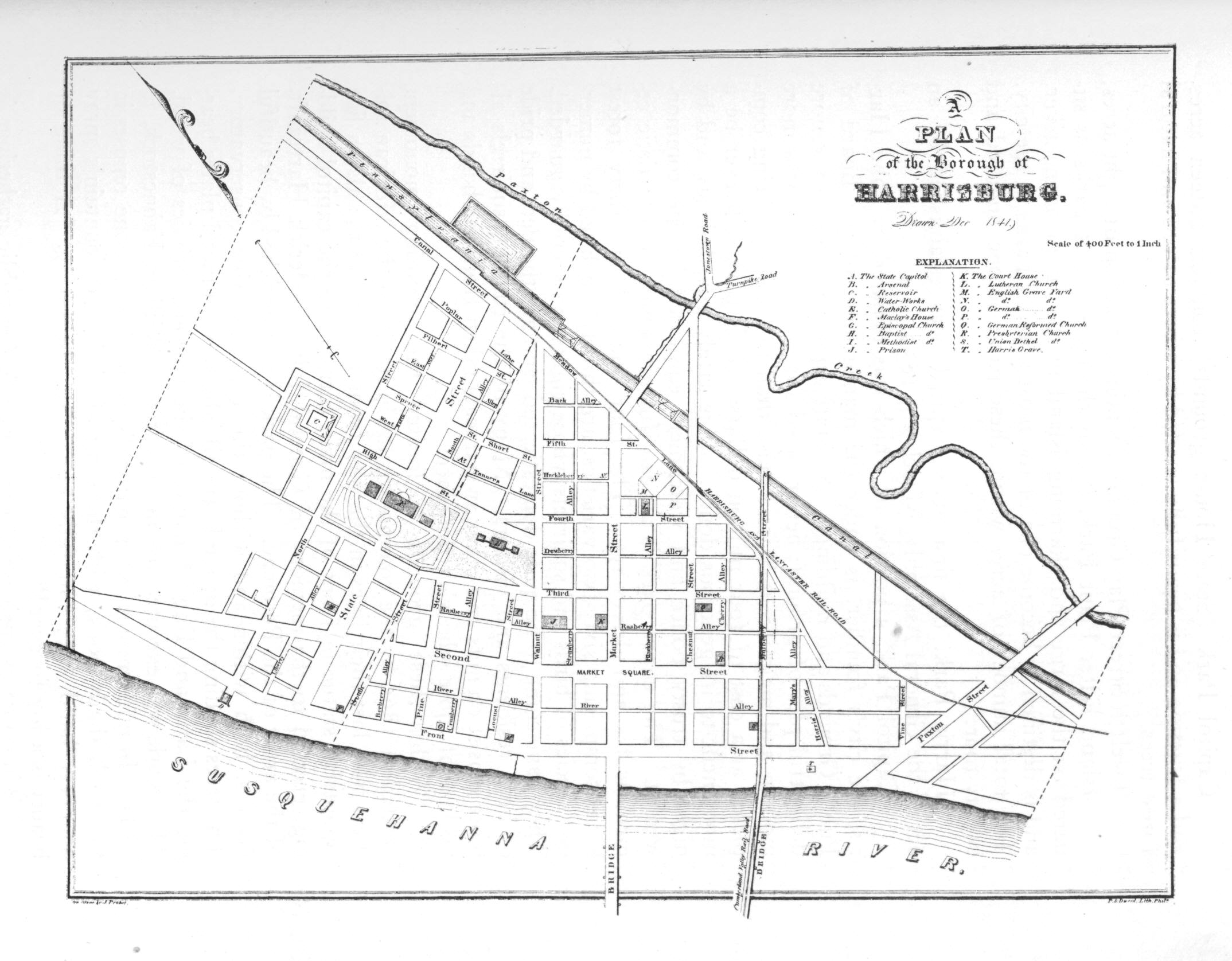
The Pennsylvania Canal
The entire nature of this area changed drastically by 1826, when construction began on the canal lock at the end of Walnut Street. The Eastern Division of the Pennsylvania Canal was laid out from Middletown, where it connected with the Union Canal. It then ran north along the east bank of the Susquehanna River through Harrisburg to the Juniata River. The canal ran roughly parallel with the edge of the borough of Harrisburg, following the swampy lowland to the east. In order to raise the water level enough to permit navigation through this area, a canal lock and considerable fill were required, which changed the look of the land considerably. After the middle 1820s, people traveling east on Market would notice a more gradual and level descent from Third toward the newly constructed canal.
Even after the canal was completed, and for years later after the railroad lines were laid next to the canal, marking the establishment of an industrial corridor on Harrisburg’s eastern border, Market Street effectively ended at the canal. The last cross street before the canal was a small farm road called Meadow Lane, which cut diagonally across the east-west thoroughfares of the borough, and was a boundary of sorts between the developed town lots to the north and west and the meadowlands to the south and east. (YOJMOG, p. 500-501)
The coming of the canal changed the complexion of Harrisburg from a politcal center to a transportation and political center. It brought business, trade, prosperity, and new options for those whose business it was to aid fugitive slaves. The long, straight towpaths made ideal "roads" for escaping slaves, and some hid in the slow moving canal freight boats themselves when sympathetic crews allowed it.
Previous Next
![]()
![]()
All photographs and text on this page copyright © 2011 George F. Nagle and Afrolumens Project.
Resources
- Egle, William Henry, Notes and Queries, 1879-1895
- Frew, Ken, Building Harrisburg, 2009
- Morgan, George H., Annals of Harrisburg, 1858.
- Patriot and Union; Daily Telegraph, 1857-1863.